Flows and water levels along the main stem of the Ottawa River are within seasonal values for this time of year. With recent rainfall and additional precipitation expected across the basin today and tomorrow, water levels and flows are expected to increase gradually or remain fairly stable over the coming week depending on locations. At some locations, water levels are below navigational chart datums. See the SPECIAL FEATURE section on our Home Page for our summertime message.
In both Ontario and Québec, citizens have the primary responsibility for their safety, the safety of their property and the safety of the activities in which they engage.
Be aware of weather conditions in your area but also in upstream areas. Sign up to receive alerts from your favorite weather forecast application.
When wet weather occurs, be prepared for higher-than-normal levels: adapt your activities and secure your belongings.
Heavy rains can cause the Ottawa River levels to rise rapidly and without warning.
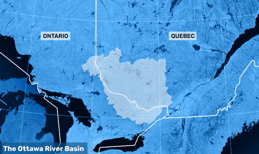
Even if it’s sunny where you live, it could be raining heavily in the headwater area of the river.
Rainwater makes its way in swales, creeks, small rivers and finally the Ottawa River.
A general message describing current and forecast river conditions is posted weekly on our website, on Tuesday, throughout the summer. If the message is revised thereafter due to significant change in weather and flow conditions, a post is sent to the platform “X”.